The Ridgeway40 Walk
40 miles on foot in one day
Checkpoint Information and Maps
| CP | Name | Grid Ref | Miles | Opens | Closes |
| Start | Avebury Sports and Social Club | SU 102 697 | 0 | 07:45 | 09:00 |
| CP1 | Whitefield Hill | SU 198 766 | 9.5 | 09:30 | 11:15 |
| CP2 | Fox Hill Car Park | SU 233 815 | 14.5 | 10:00 | 13:00 |
| CP3 | Uffington Castle | SU 294 859 | 19.5 | 10:30 | 14:45 |
| CP4 | Yew Down (nr monument) | SU 418 841 | 28.0 | 12:00 | 18:00 |
| CP5 | Compton Downs Cross Tracks | SU 509 819 | 34.5 | 13:00 | 20:30 |
| CP6 | Post Box Cottage | SU 567 812 | 38.2 | 13:30 | 22:00 |
| Finish | Morrell Room Streatley RG8 9HT | SU 594 808 | 40.0 | 14:00 | 22:30 |
| CP | Name | What3Words | Opens | Closes |
| Start | Avebury Sports and Social Club | pricier.handyman.coping | 07:45 | 09:00 |
| CP1 | Whitefield Hill | churn.strong.shout | 09:30 | 11:15 |
| CP2 | Fox Hill Car Park | rinses.goat.brightens | 10:00 | 13:00 |
| CP3 | Uffington Castle | packing.overjoyed.rejoined | 10:30 | 14:45 |
| CP4 | Yew Down (nr monument) | inquest.derailed.thuds | 12:00 | 18:00 |
| CP5 | Compton Downs Cross Tracks | ventures.battle.grounding | 13:00 | 20:30 |
| CP6 | Post Box Cottage | curry.collected.alarmed | 13:30 | 22:00 |
| Finish | Morrell Room Streatley RG8 9HT | cubes.stun.sprawls | 14:00 | 22:30 |
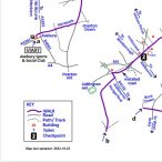
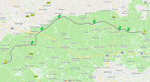
| Ridgeway40 Route Map | |
|
Most of the walk follows the National Trail way-marked as
the Ridgeway. Please pay attention to the map In areas with many paths such as the few miles
after Bury Down (32 miles), way-marks should help keep to the
correct route. The walk
is different from the National Trail between Barbury Castle
and Whitefield Hill (see note below that section on the map) Updated Oct 2023 To download [click here (svg)] |
 |
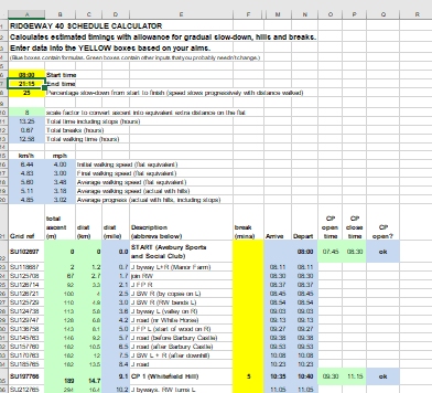
| Ridgeway40 Scheduler / Planner (spreadsheet) | |
|
Take the advantage in downloading our scheduler / planner
speadsheet. Input your Start and expected Finish time and
the calculator will do the rest in working out your expected
Checkpoint times. You can even input breaks times. The
yellow cells are for user inputs. Happy walking! Many thanks to Alan Iwi for the work in creating and updating this utility. To download the Scheduler / Planner Speadsheet [click here] |
 |
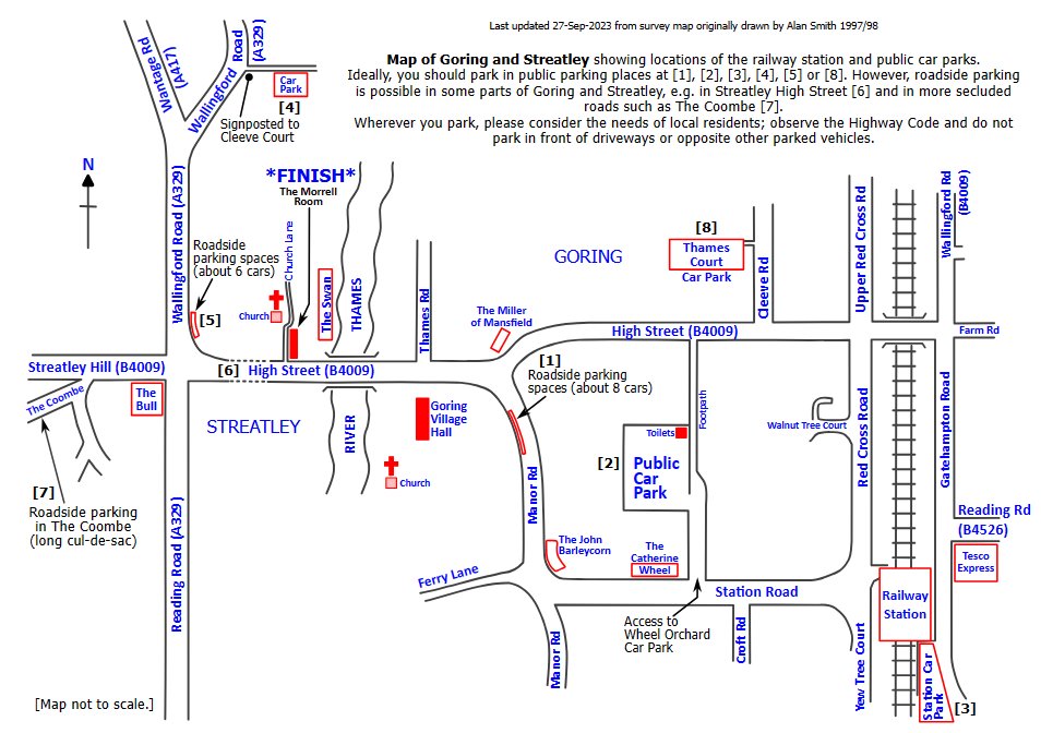
| Goring and Streatley Town Map | |
|
Map of Goring and Streatley showing locations of the Village
Hall, railway station and public car parks. Updated Oct
2023. To download the map [click here (jpg)] |
 |
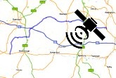
| Google Maps | |
|
We have entered the Ridgeway40 Route into Google Maps. Click
the link below to see a satellite and terrain view of the
route. Updated Oct 2023. To access the map [click here] |
 |
| GPX (GPS Exchange Format) | |
|
GPX, or GPS Exchange Format, is an XML schema designed as a
common GPS data format for software applications. It can be
used to describe waypoints, tracks, and routes. Updated Oct
2023. To download the GPX file [click here] |
 |
Finishing Results / Times now available
Memories of Past Events
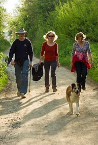
Everyone welcome including mans best friend (photo Dave Dare)
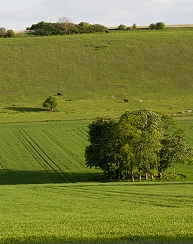
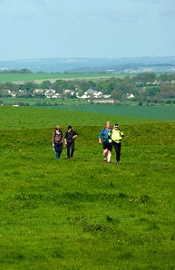
Lovely countryside to discover during the walk (photos Dave Dare)